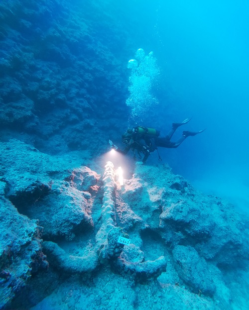
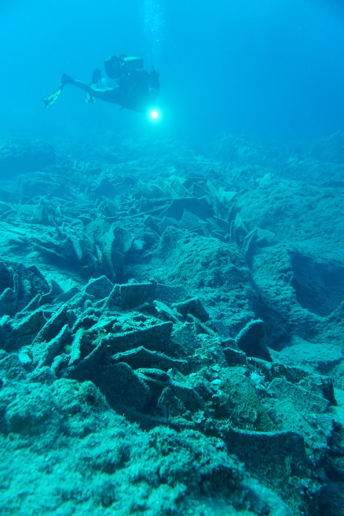
Mersin shores, Tile wreck

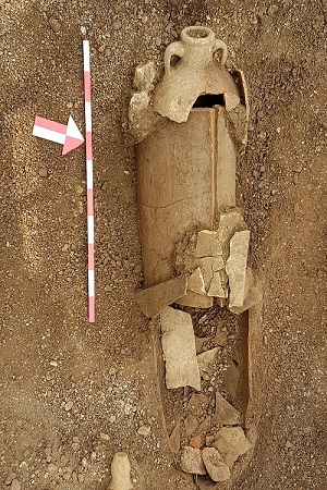
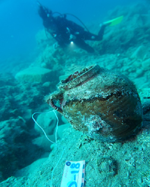
Mersin shores, Terracotta pot
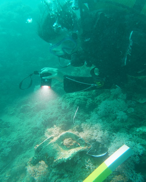
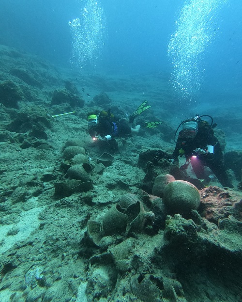
The archaeological underwater surveys on the shores of Mersin have been conducted since 2015.
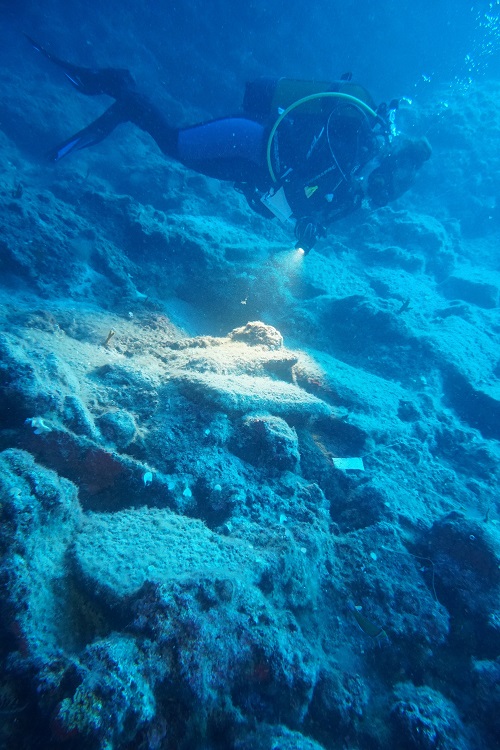
The surveys utilized traditional underwater survey methods, in addition to sonar scanning, various applications of ROV (Remotely Operated Vehicle), and aerial photography with marine drones. These efforts have revealed 65 ancient shipwrecks and numerous archaeological remains. Masks, fins, and snorkels were used for snorkeling in shallow waters, such as capes, rocky shores, and harbor areas marked on the map below, while scuba diving was conducted in deeper waters.
Possible locations where boats could capsize, as well as natural and man-made harbors, were surveyed. These methods were used in combination with towing the diver by a motorboat or with underwater scooters, allowing large areas to be scanned where shipwrecks or artifacts might be located. Additionally, underwater survey methods using electronic equipment were applied, including scanning large areas with side-scan sonar, multi-beam sonar, and sub-bottom profiler; recording images obtained with relevant GPS coordinates; and scanning the seafloor with ROV and magnetometer when required by sonar imaging or where diving was not feasible due to depth.
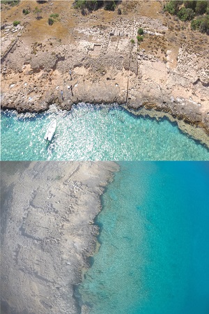
This work was performed in the areas named below, where various shipwrecks, harbor structure ruins, anchors, and other archaeological findings were identified. These findings confirm the presence of a significant maritime history along the mountainous and low-lying Cilician shores, ranging from the Bronze Age to the Ottoman Period.
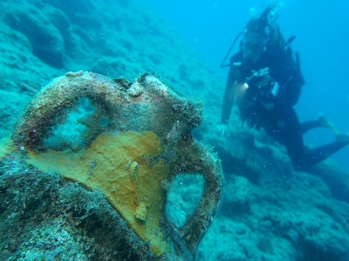
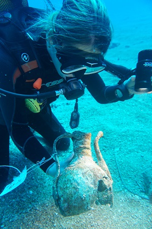
(Mersin Shores: Amphora Upper Body Part)
Adana
Mersin
Hatay
Antalya
Kumluca Shipwreck
Idyros Ancient City
Dana Island
Ottoman Shipwreck
Besmi Shipwreck
Hacıvatburnu Shipwreck